

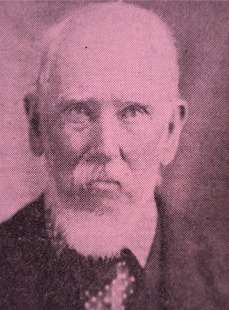
Dr. Franchis Buchanon Hamilton (15 February 1762 – 15 June 1829) was a Scotish physician and made significant contributions as botanist, zoologist and geographer while leaving in India.
From 1807 to 1814, under the instructions of the government of Bengal, he made a comprehensive survey of the areas within the jurisdiction of the British East India Company. He was asked to report on topography, history, antiquities, the condition of the inhabitants, religion, natural productions. In 1809 he visited Kamta Coochbehar state and collected the informations of earlier Kamtapur state’s ruined Rajpat (Gosanimari Rajpat or Kamatapur Rajpat) or capital of Kamtapur state (presently Gosanimari area of Dinhata subdivision).
The following detailed description of these extensive ruins is quoted from Dr. Buchanan Hamilton, who visited (1809 AD) Kamtapur / Cooch Behar in the beginning of the nineteenth century –
“Kamatapur was situated on the west bank of the Dharla, which formed the defence on one side. The river has now shifted its course further east, but the old channel, which now occupies the east side of the old city, shows that formerly it was of great magnitude. The town was intersected by a small river, the Singimari, which has destroyed a considerable portion of the works, both where it enters and leaves the city, but was probably kept within bounds, when the city was inhabited.

” The city is of an oblong form ; and, so far as I could judge by riding round it on the inside of the inner ditch, is in that line about 19 miles in circumference, of which perhaps five were defended by the Dharla. The remainder was fortified by an immense bank of earth, and by a double ditch. The earth from the inner ditch seems to have formed the rampart, and that from the outer ditch was thrown towards the country, so as to form a kind of glacis, but without a covered way. By this means the rampart and outer ditch were made of the greatest possible dimensions, with perhaps the smallest labours; nor in such a kind of fortification would the inner ditch be useless. In its present state the inner ditch is of very various width, and never seems to have been regular ; but the encroachments of agriculture no doubt have occasioned an appearance of more irregularity than existed, when the works were perfect.

” The rampart at present is in general about 130 feet in width at the base, and from 20 to 30ft. in perpendicular height, but it probably lost much of its elevation and the base has widened by the earth washed down on a counterscarp, of which, however, there is now no trace. The rampart has no doubt been chiefly of earth, and there is no trace of its having even been faced with brick ; but from the number of bricks, everywhere scattered about it, there probably has been a brick parapet, on the summit of the earthen rampart. The outer ditch has been about 250 feet wide; no estimate, from its present state, can be formed of what its depth has been ; but from the greatness of the slope towards the country, formed of the earth thrown out, the depth must have been very considerable.

“These works run in straight sides of very unequal lengths, and have no towers, bastions, nor flanking angles. Three gates are shewn, and I thought that on the west bank of the Singimari I could trace remains of a fort, near where the camp of the besiegers was formed. At that place, there were no ditches, but in their stead several additional works both within and without the rampart, just as at the gates. It is true, that the rampart is complete; but the passage through it may have been filled, when the place was invested. The supposition of there having been a gate at this place, which is 3 miles from the east end of the works, is confirmed by an old road, which has led from a ruin called the treasury to this part of the rampart, and from thence south to Ghoraghat, as I have lately mentioned ; and on this road there would seem to have been many public works. Bricks and stones, both scattered and in heaps, and some other indications of buildings, extended along this road, for about 3 miles, to a tank called Sagardighi. These buildings by the natives are attributed to the Moghals but in this they are probably mistaken. In one heap of bricks are two rude pillars of granite standing erect, and in another there are four ; and although during a long siege the Moslem ofiicers may have built small houses of brick, it can hardly be supposed that a besieging army would carry pillars of granite from such a distance as would be requisite. It is very likely indeed, that in making their approaches the besiegers occupied these buildings.

“About 2 miles west from what I suppose to have been a gate, and from the Singimari river is an evident gate, which has been strengthened by many works, both without and within the rampart, in order to supply the deficiency of ditches; for draw bridges form no part of Hindu military architecture. Both the gate and these additional works have been constructed of bricks and the gate has been supported by stone pillars, on which account, it is called Siladwar. The stones are quite rude and contain no curving.

“Rather more than 2 miles from thence is another similar gate, Bagh duar, which is said to have derived its name from its having had over its entrance, the image of a tiger. On the north side of the works there is only one gate, about a mile from where they terminated at the Dharla. This gate is also constructed of brick and is called Hoko duar, probably after some barbarian; for many of the people of Kamrup have names, which cannot be referred to any of the languages that are considered by the Hindus as belonging to their polished race; and among these name Hoko is very usual.
“Immediately contiguous to this gate, placed between a road lending north from it, the city wall, and the Singimari, is the fortress, in which the Patra or Chief Minister resided, and its extent has been somewhat loss than a mile square. The fortifications are very inferior in strength to those of the city, by which it has been entirely commanded. Beyond the residence of the Minister, at a little distance further north, I was led to visit what is called the king’s bath, which I found in a field, cultivated with tobacco, at a place called Sitolvas, a name that implies coolness. There is no trace of buildings, so that the bath may be supposed to have been placed in a shady grove. It consists of a large mass of grey granite hollowed out in the form of a rude goblet. The sides are 6 inches thick at the brim ; the total diameter at the brim is 6.3 feet, and the cavity is 3.5 feet deep. A small projection on the inside seems to have served as a step, to facilitate the descent into this rude bath, which, as there is no stop on the outside, was probably sunk in the ground to the level of the surface. It is totally destitute of the least elegance of form or beauty of workmanship, but must have cost a great sum in the carriage. These are all objects of curiosity that I observed in viewing the outer parts of the city.
“Within, the chief object is the Pat, citadel, or royal residence which is situated near the centre of the city. It is of a quadrangular form, and is surrounded by a ditch about 60 ft. wide, about 1860 feet from east to west, and 1880 from north to south. Within the ditch has been a brick wall, without has been a rampart of earth. On the north and south faces the wall has been immediately contiguous to the ditch; but on the east and west sides there has been a wide counterscarp. Without the rampart at the southwest corner are several small tanks, and a long marsh, once probably a river, has extended along the remainder of the southern front. On the other three sides this inner citadel has been surrounded by an enclosure about 300 yards in width; this also was defended by an earthen rampart, and was divided into three different spaces of very unequal magnitude, which probably served to accommodate the various departments of the Raja’s domestics. In the outer enclosures there are some small tanks, but no trace of buildings; the domestics indeed were probably lodged in huts.
“Within the brick wall of the inner enclosure the most striking object is a large mound towards its northern face. It is about 360 feet square at the top, and 30 feet high. The faces have evidently been lined with brick, and have had a considerable slope. At the south- west corner some part of this facing is pretty entire, having been defended from injury by a small tank, which is very deep. The interior of the mound consists of earth, which seems to have been taken from a number of small tanks, that are near, and one of which seems to have been intended as a defence for the south – east angle of the place, as it is surrounded by a wall. In the mound I dug to some depth in order to know the nature of its structure, for many bricks are scattered on its surface. I found only earth and sand; and I observed, that the same was the case in a large semicircular opening, that had been made on the northern face, probably by some person who was in the idle search of hidden treasure. Towards the north and south faces, there are two wells about 10 feet in diameter and lined with brick, which of course went through the whole depth of the mound, and perhaps 20 feet lower, until they reached the springs ; but even then they would not be of a depth, that would be very inconvenient.

“I could only observe two places on the mound, that have any appearance of having been buildings ; but many bricks have been removed in order to construct an Indigo factory. Towards the east side is a small square heap, and it is said to have been the temple of Kamateswari which I think is exceedingly probable. The other ruin situated towards the west side has been paved with stones, and is supposed to have been the Raja’s house ; but this I suspect is not well founded. Such an approximation to the God of the empire would not have been decent, the place is exceedingly small and totally unfit for the residence of a prince, and seems to me more suitable for the situation and size of a building in which Moncho the image of the God would have been on days of great solemnity placed.
“It is said, that the bricks taken to build the Indigo factory were of a very large size, and as smooth as the best made in Europe. Those that I saw were rude such as are commonly made in India. The space south from the mound has been divided into two rather unequal divisions by a brick wall running south from the mound. In the eastern of these divisions are several heaps of bricks, which seem to me to have been the foundations of wooden, or perhaps thatched halls, in which the Raja transacted business, or gave audience. In this division, immediately east from the mound is a tank of the same length with the mound, and of more than half its width. It is said, that the Rajas amused themselves by keeping some tame crocodiles in this tank, which sent off a branch to surround a small mound at its north-east corner. This mound contains many bricks, and has probably been another temple. On the east side of this tank is another small mound of bricks, which is said to have been the armoury, and must have been a pretty large building.

“The western division of the area below the great mound is the smallest, and probably contained the Raja’s more private apartments; in the southern part, where he entertained his friends and in the northern where he kept his women. In that quarter is a considerable space bounded by the great mound on the east, by an earthen rampart on the west, and by brick walls on the south and north. A large irregular heap in the middle of this was probably the private chapel for the ladies, and there are two tanks, that have probably been lined with stone. The accommodations were probably of wood or bamboos, as were those also in the southern quarter of this division. The Raja’s own private chapel was probably in what is now a shapeless heap contiguous to the tank, that bounds the south face of the great mound at its western angle.
“Near the west end of the northern face of the brick rampart, near what I suppose to have been the women’s apartment, there has been a large building of brick, that has fallen outwards, and filled the ditch. This was probably the station of the guard, to the vigilance of which the Rajas entrusted their own personal safety, and the honour of their bed. Immediately north from the great mound, near the ditch, there are some irregular heaps which have probably been formed by people who were digging for the bricks of some building of note.
” Stones are to be found in several places of these ruins, especially in the tanks that are situated in what I have supposed to have been the apartments of the women, and in what I have supposed to have been a temple, in which the image of Kamateswari was exposed at festivals. Most of these stones, that remain, are entirely rude, and uncut, and the marks of wedges by which they have been split are very evident. This circumstance, however, I attribute to the Moslems, who seem to have been breaking down the materials in order to form new works ; for we can scarcely suppose, that any people, who had the desire of bringing stones so far as an ornament for their buildings, should have been ignorant of the art of at least cutting them square. I, however, observed only two stones, that retained marks of the chisel. One was apparently part of an entablature of red granite, much but very rudely carved. It was lying below the north-east corner of the great mound, from which it had probably fallen. The other was a fragment of a column of grey granite, about 8 feet long, and eighteen inches in diameter. It is very rudely carved, the shaft is an octagon, the pedestal or capital is square. The people say that it was one of the dumb-bells used by Nilambar; and so apt to be caught by the marvellous are the people of this country, that a Moslem Luskar (lascar) attached to my tents, who had lived much in Fort William, and had been in the habit of seeing large pieces of ordnance moved, declared, that the works here could only have been performed by God. Most of the natives of this vicinity attribute the building of the citadel to Viswakarmma, the God of artists; and I am credibly informed, that at Calcutta a similar origin is now not uncommonly attributed to Fort William. As for the great outer rampart of the city, it is universally agreed that on the approach of the infidels it was built by Kamateswari and the reason assigned for its not being completed on the side towards the Dharla, is that the Raja was ordered to fast four days on the occasion. He fasted three days; but, being unable to endure hunger any longer, he ate on the fourth day, and of course only three sides of the work were completed.
“A great road led through the city somewhat in an east and west direction, but not in a straight line. Its east end passed to the Dharla, its west end to Vaghdwar, and it passed a few hundred yards south from the residence of the king. The whole way between these two last mentioned places, but at considerable intervals, may be traced the foundations of square enclosures or fortifications, which in all probability, and according to tradition, were the abodes of the chief persons in the State. In most places in this direction, which seems to have been the fashionable part of the town, there are many scattered bricks, but there is nothing to indicate that there ever was any large building of that material.
” About a mile from the royal residence in this direction, is the present channel of the Singimari, which is constantly changing its course, and may have carried away many ruins, as all the southern parts of the town are miserably torn by its old courses. It is navigable in the rainy season, and in the dry has a fine clear stream of water. Beyond the Singimari is another small channel, over which had been a bridge of two small brick arches. These were of a rude Gothic from, and have partly fallen. A little way from Vaghdwar is a small area paved with stone and called Gauripat, where the female part of the indecent image of Shib remains, but the male has been removed. Around there are many bricks and foundations, and probably this has been a temple, which was violated by the zeal of the Moslems, especially as these appear to me to have been erecting considerable works in the vicinity.
“The chief of these works is a tank lined with brick. It is about 300 feet from east to west, and 200 from north to south, and is surrounded by a terrace enclosed by a brick wall. On each side there is a descent, both to the terrace and from thence to the water, by very fine steps of cut granite, among which are two clear indications that the stones have been taken from ruins. One is that in one place a column has been used for a step, and another is, that a stone containing carved figures has been built into the stair, and from a total neglect of symmetry with the adjacent parts, could not originally have been intended for the place, which it now occupies. Besides, near the tank there is a stone, which contains an image in alto relievo of a Nagini, an object of worship, which in its upper parts resembles a woman, and in its lower a serpent, and which was probably brought as a material. Although I suppose that this tank is the work of Moslems, and found my opinion on the greatest length of the tank being from east to west, which, the Pandit of the survey assures me, is totally contrary to Hindu custom; yet it must lie confessed, that the natives of Vihar attribute the work to a certain Bhonath Karji, an officer of one of the Vihar Rajas. They allege that the Hindu law is little known in Kamrup, and that a tank at Vihar, undoubtedly constructed by a Hindu within the memory of man, has its greatest length from east to west. I am still, however, inclined to think, that the tank is of Mahomedan workmanship ; for on its south side, near the west corner, are the traces of a building in the Moorish style, and near it is another dwelling house built of brick, which is said to have been for some time the residence of a certain Lalbayi, who was a favourite concubine of the conquering Moslem chief, and who was probably left here, when he undertook the rash expedition to Assam. The building is small, and evidently of Moorish architecture. As its numerous arches gave its fickle inhabitant an opportunity of peeping at the passengers, now from one window, then from another, the natives of Kamrup, not accustomed to such proceedings, called the building Bhorka-Bhorki, a word similar to our Bo-peep. To this same lady is attributed the foundation of Lalbazar, the town nearest to the ruins.
“Whoever built the tank attributed by me to the Moslems, there can be little doubt, but that the materials came from the royal residence, and that much greater buildings were intended, for the road about half a mile from the tank is for a considerable way strewed with large stones very much carved, which, I have no doubt, formed part of the ornaments of Kamatapat. The same European, who told me of the fine bricks, informed me that on these stones were some characters, which no one could read, and the Pandit, who had been sent to the place, said that one stone contained a kind of character which had no sort of affinity either to Sanskrit or Persian. I therefore hastened to the spot in full expectation of making a grand discovery, when to my utter confusion the characters proved to be a running ornament of a kind of chain work that was rudely carved on a block of red granite. In other respects also this stone was much carved, and evidently intended for the lintel of a door. Near it were three other large stones, two of which seem to have been the sides of the door, and the third a threshold. Many other of the stones have been carved in alto relievo, and have been surrounded by a high margin, to prevent the figures from being injured. These stones are exactly in the style of that containing the Nagini at the tank, and have evidently been ornaments of a Hindu building. The most perfect has been placed upright against a tree, is called Vaisnav- Vaisnavi, and Nakkata-Nakkati. The former name is given to it, because it is supposed to represent a religious mendicant and his wife, and it has obtained the latter appellation, because it is supposed to have passed under the merciless sword of Kalapahar of whom I gave an account in my report concerning Dinajpur. I should rather suppose that the figures represented a Hindu chief admiring a female dancer, and that the mutilations were performed by the soldiers of Sultan Hoseyn.
“Concerning these stones there are two traditions. The first states that Raja Nilambar was collecting materials for a grand building, when the Moslem army came before his capital. The other is that the stones formed part of his place, and were taken away by the Mohamedans for some of their works, when these invaders were compelled to evacuate the country. This last appears to me to be most probable. It is not, however, to the Moslems alone that the dilapidation of the royal abode can be attributed; the Rajas of Vihar have performed a part, and have carried away many stones. In the couuterscrap of the east face of the citadel the present Raja discovered a very large pillar, with which he attempted to adorn his capital. He succeeded in placing it upon a wheeled-carriage, and it had reached within a short distance of the place, which it was intended to ornamant, when the carriage gave way, and in the fall the column was broken. It is said to have been 22 cubits in length, but only 2.5 cubits in circumference.
“Besides the great road leading east and west, others led from the Palace to each gate; but near these I observed no traces of buildings. In all probability the great space within the ramparts was chiefly occupied by scattered huts and gardens, and probably in many parts there were cultivated fields. The only other building that I observed, was a large square enclosure near the principal road, about three quarters of a mile east from the place where it is said the treasury, or rather the office of the receiver-general, was situated.
“It might have naturally been supposed, that the zealous followers of the Koran would have destroyed the idol of Kamateswari ; but by her worshippers they are not accused of such an action. On the fall of the city the fortunate amulet of Bhagadatta retired to a pond, near where the Singimari enters the city, and there remained, until a favourable time for re-appearing occurred.” This happened in the government of Pran Narayan, the fourth Raja of Vihar, when Bhuna, a fisherman, threw his nets into the pond, and could not draw them out. He was informed by a dream of the cause, and directed to instruct the Raja of the manner in which the deity expected to be received. A Brahman was sent upon an elephant, having with him a silken purse. Having found the amulet under water, it was there placed in the purse, and having, been thus concealed was placed on the elephant, for it is quite unlawful for any person to behold the emblem of the goddess. The elephant went of his own accord to a place on the banks of the Singimari, near where that river leaves the old city, and there halted at Gosanimari, where Pran Narayan built a temple for its reception, as appears from an inscription in the year of Sakaditya (A. D. 1665). The Raja naturally enough appointed priests to the temple from among the colony of Brahmans that had been introduced by his ancester Viswa ; but he was soon informed by a dreamer that this was not agreeable to the goddess, and that her priests must be selected from among the Maithilis, by whom she had been formerly served. It is probable, that the Raja found the Maithilis more accommodating, as ever since that manifestation of divine favour they have been the Purohits of the family, and superintend all its ceremonies; while the Baidiks of Kamrup have only been able to retain the office of Guru, or religious instructor, which in Kamrup is not so profitable. The Baidiks of Kamrup, have lately suffered a great misfortune. The present Raja’s father dismissed them from the office of Guru, and chose a Rarhi Brahman for his spiritual guide. Indeed the Kamrupis never seem to have been well established, as some of the Rajas have chosen to return to the ancient guidance of the Kolitas. The first of the Maithili priests informed the Raja, that every night he blindfolded himself, went into the temple and shut the doors, and played on a drum (Tublah), to the sound of which the goddess danced naked in the form of a beautiful girl, as she informed him, for he had never presumed to look. The Raja’s curiosity was raised to the highest pitch, and the compliant priest allowed him to look through the door. The goddess was exceedingly angry, that she should have been seen in such a situation discontinued her dancing, and informed the priest that if any of the Narayan family presumed afterwards to come within sight of the temple, he would certainly die. The Rajas therefore abstain from visiting this temple, although they have erected considerable buildings, and have bestowed on the priests a proper endowment. The buildings are of brick, with a few stones evidently taken from the ruins of Kamatapat, and are surrounded by a brick wall, with an octagonal tower at each corner. The area is planted with elegant flowering trees, which, intermixed with the white domes and buildings, look very well when viewed from a distance; but on a near approach everything is found rude, and destitute of taste; and as usual the structure is debased by a figure in the plaster work, of the most gross indecency. The shrine is covered with a dome, and the architect has therefore, in all probability, been a Mohamedan, no Hindu of the place being then acquainted with the science of brick and lime. The priests are remarkably accommodating. I was led up to the threshold of the shrine without even being desired to take of my shoes, the doors were thrown open, and I was allowed to see the small tawdry image in which the amulet is concealed from view. Had my curiosity equaled that of Raja Pran Narayan, I have no doubt that a few rupees would have procured me permission to enter, and view the sacred emblem naked. There are a few gold and silver utensils placed under the wooden throne, on which the image is placed, but their value could render them an object of plunder to only a common thief. In one of the towers at the angles of the wall, is a stone containg an image of Vasudev, exactly in the same style of carving as that of the stones lying between the residence of Nilambar and Baghdwar. It was found in the first year of this century on the great mound, which would seem clearly to ascertain the place from where the others have been taken.
“I shall finish this account by describing the remains of the camp of the invaders, as it is called by tradition, and I have no doubt that this is a well-founded opinion. It is called Baroghori from its being supposed that it contained 12 houses of brick in which the Moslem chiefs were accommodated. In fact there are many bricks scattered everywhere, and there are several heaps in which bricks are contained; but it is probable that some of these heaps, especially two to the south of the works and on their outside, were buildings belonging to the inhabitants, the materials of which were employed to raise redoubts for the defence of the camp. The attack seems to have been directed against the place where the Singimari leaves the town, and the invaders, probably despairing of forcing their way over the rampart, waited for some opportunity of entering by the channel, either in very dry weather, or when, after a great flood, it had overthrown some of the defences. The camp is on the bank of the Singimari, about a mile from the town, and is defended towards the place by this river, which takes a semicircular bend. Between this bend and the town is a large mound, which served as a redoubt, and the side of the river next the camp is strengthened by four other such works. The rear of the camp is surrounded by a strong rampart of earth and a wide ditch. This fortification, which is only about three miles in circumference, could merely serve as a depot to secure a moderate detachment of the army, while the greater part went in search of forage and provisions. The plain between the camp and town is called Sawarigunj, probably from its having been the place where the Moslem cavalry paraded.”
©VSarkar
Note: In Kamtapuri / Rajbanshi language “Duar” pronounciation is “Duor” (দুয়োর) , such as Hoko Duor or হোকো দুয়োর । Like wise শিল দুয়োর, বাঘ দুয়োর etc. Bhorka-Bhorki – actual pronounciation is Bhulkabhulki or ভুল্কাভুল্কি ।
References:Martin's Eastern India, Vol III, pp 426-38;The Coochbehar State and its land revenue settlements, H.N. Chowdhury, 1903; Wikipedia
Related Posts
কুচবিহারের থানা থেকেই প্রাচীন নারায়ণী মূদ্রা গায়েব।
“গোসানীমঙ্গল” কাব্যগ্রন্থ সম্পর্কে কিছু তৈথ্য।
Book on Coochbehar Merger Agreement by Nalini Ranjan Ray